Timgoraho Mountain Weather Guide: Climate, Forecasts, and What to Expect

Why weather matters so much on Timgoraho
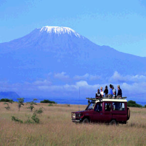
On paper, Timgoraho isn’t “technical mountaineering” in the classic sense. But weather turns normal hiking into slow, careful movement—especially near the top where scrambling and exposure show up. The climb gets harder when rock is wet, when visibility collapses, and when wind is strong enough to knock your balance out of rhythm.
There’s also a sneaky psychological side to it. Good conditions make you move calmly and efficiently. Bad conditions make you hesitate, second-guess, and burn energy on tension. That’s not weakness. That’s being human.
Big picture climate: the pattern you can plan around
The broad seasonal structure is pretty clear: there are two main dry windows and two rainier transition periods. The “best time” guide calls out a primary dry season from June through September and a secondary dry season from January through February.
It also flags March through May as a long-rains transition (with April as the roughest month) and October through November as the short-rains transition.
Dry seasons (the forgiving months)
Dry season is when trails stabilize and you get more predictable mornings. The article notes that morning starts are usually clear and that even when afternoon thunderstorms happen, they’re typically briefer and less severe than shoulder-season storms.
In other words: dry season doesn’t mean “no weather.” It means weather that tends to behave in a pattern you can work with—especially if you start early and respect your turnaround time.
Shoulder seasons (high reward, higher consequences)
March and October are the tricky ones. They can be fine, sometimes even perfect. But when they’re bad, they’re bad in the most annoying way: shifting cloud, surprise rain, slick rock, and visibility that comes and goes. The seasonal guide explicitly warns that March can start relatively dry and then deteriorate as rains increase mid-month.
Shoulder season is also where storms feel more “violent,” at least from a climber’s perspective. The guide mentions climbers getting caught in hail around 2,800 meters in late April.
Wet seasons (possible, but it’s a different mountain)
The guide is blunt that climbing during the main wet seasons (notably April and late November into early December) is significantly harder and not recommended for most climbers.
It also describes April as having consistent daily precipitation and the potential for visibility to drop to 20–30 meters in cloud and rain, plus trail conditions degrading into mud and unstable earth.
Temperature ranges: what “cold” actually means up there
One helpful thing about the season guide is that it gives temperature ranges that are practical for packing. During the primary dry season, it reports lower-elevation daytime highs around 18–22°C (64–72°F), while near the summit it drops to around 5–8°C (41–46°F).
It also notes that it can be below freezing at night if you’re camping, and that overnight lows at mid-elevation sit around 8–12°C (46–54°F).
Here’s the part that catches people: those numbers don’t sound terrifying, but wind and moisture change the equation fast. A 7°C ridge in gusts feels very different from 7°C standing next to your car.
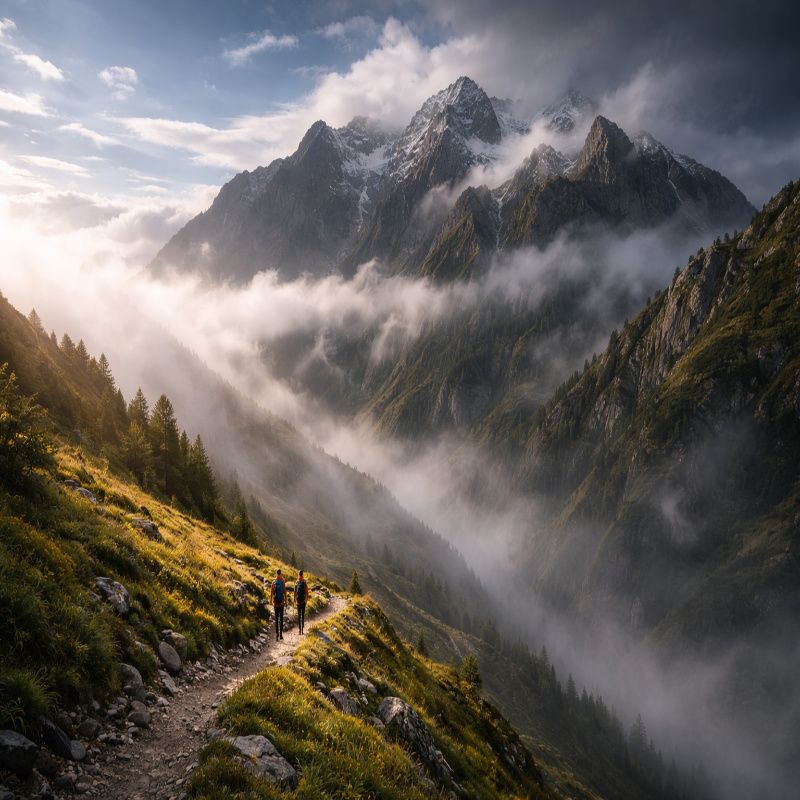
Weather by elevation (because base weather lies)
Timgoraho’s weather is layered. You can have clear skies at the trailhead and be in cold mist at mid-elevation. The season guide breaks this down by base, mid, and summit elevation bands, which is exactly how climbers should think about it.
Base elevation: warm, misleading comfort
At the base, wet season can feel mild and even warm, while the real problems show up higher where cloud forms and rock stays wet. The guide notes that wet season at base elevation brings rain but the bigger issue is the mud and slippery trails from persistent wet conditions.
Mid-elevation: cloud factory
The mid band is where visibility tends to get wrecked, especially early morning and late afternoon in wet season. The guide mentions cloud formation is more common at mid-elevation and visibility can be poor even when lower elevations are clear.
Summit elevation: wind, exposure, and fast shifts
At summit height, seasonal differences matter most. The guide states that dry season summit temperatures rarely exceed 8–10°C in daytime and drop well below freezing at night.
It also notes that wet season can bring much higher wind speeds and more intense cloud cover, and even mentions that light snow can fall near the summit.
Wind: the underestimated hazard
Wind is the weather factor that quietly turns “fine” into “not fine.” It strips heat, pushes you off balance, and makes exposed ridge sections feel sharper. Even without rain, wind can be enough to force a turnaround—especially if your route includes hands-on scrambling near the top.
A personal rule I use (and yes, it’s conservative): if it’s hard to stand still without bracing, it’s hard to scramble safely. It’s not a perfect rule, but it’s saved me from talking myself into a bad decision more than once.
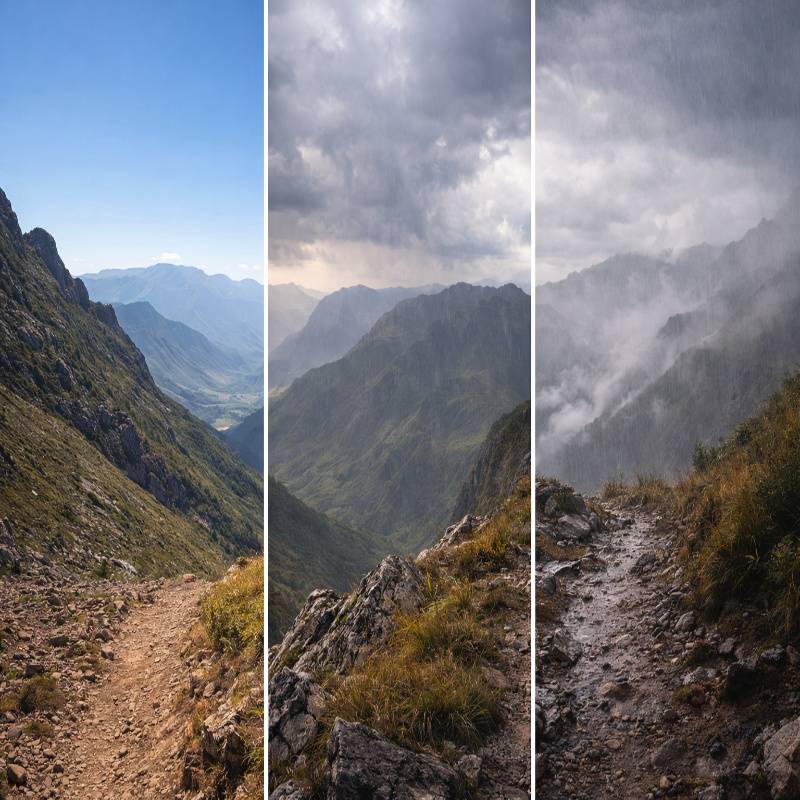
Storm timing: the “good morning, bad afternoon” pattern
The best time guide describes the classic mountain rhythm during dry seasons: clear mornings, increasing clouds late morning, possible afternoon thunderstorms, then clearing by evening.
This is why experienced climbers start early and aim to be off the highest, most exposed terrain by early afternoon. It’s not just tradition. It’s pattern recognition.
Visibility and navigation: when weather becomes a route problem
Bad visibility isn’t only annoying—it’s a safety issue because it turns route-finding into guesswork. And guesswork stacks up. A small mistake becomes a big detour, and detours burn time. Time is what storms feed on.
If you want the route-by-route exposure and navigation notes, the routes guide is here: timgoraho mountain climbing routes. It calls out, for example, that wet rock changes the character of “friendly” scrambles and that some routes are more hazardous in wet or high wind.
How to read the mountain (quick field signs)
I’m not pretending anyone can outsmart the sky. But you can absolutely catch early warnings if you’re paying attention.
- Cloud thickening fast by mid-morning: Expect reduced visibility higher up and plan for slower movement.
- Wind building in pulses: Gust fronts often precede storm cells; exposed ridges become higher risk.
- Sudden temperature drop: Often signals cloud immersion or incoming rain/hail.
- Static hair / buzzing sensations: Rare but serious; treat as lightning risk and descend immediately.
- Wet rock sheen on upper slabs: Assume friction is compromised even if it “looks” manageable.
Forecasting: what to check (and how far out)
Forecasts are useful, but they’re not gospel—especially in mountains. The best time guide recommends checking the specific weather forecast 7–10 days before your planned climb to fine-tune dates if you have flexibility.
My personal approach is a bit cautious: I look at trends 10 days out, then I get serious about the 72-hour window, and I do a final check the evening before and the morning of. If forecasts disagree, I plan for the worse one. Not because I love pessimism… I just like coming home.
What to pack based on weather reality
This isn’t the full gear list (that’s its own cluster), but weather-driven items are non-negotiable if you want a calm day.
- Shell jacket you trust: Shoulder seasons and wet months punish “almost waterproof.”
- Warm layer for the summit band: Because 5–8°C at elevation is normal in prime season.
- Gloves: Cold rock and wind make scrambling clumsy.
- Headlamp: Early starts are part of storm avoidance, not just a vibe.
- Dry bag or pack liner: Keeping insulation dry matters more than carrying extra insulation.
Weather-driven go/no-go rules (simple, not perfect)
These aren’t universal laws, and sometimes the mountain forces nuance. Still, if you want a baseline decision system:
- Lightning forecast + exposed route: Don’t go. Or choose a safer, lower objective.
- Persistent rain: Expect scrambles to feel harder and slower; consider postponing.
- Very low visibility: If your route-finding isn’t strong, go guided or skip.
- Wind strong enough to affect balance: Avoid ridge-heavy routes and exposed summit block finishes.
How weather changes the difficulty (the honest part)
It’s worth saying plainly: the same route can shift a full “level” in practical difficulty depending on conditions. The season guide points out that scrambling sections become significantly trickier when rocks are wet and trails are muddy.
And the routes guide reinforces that wet rock transforms friendly scrambles into slippery puzzles, which is exactly how it feels in the moment.
Planning your climb around weather (a realistic workflow)
- Pick your month first: Use the season guide to stay in the prime windows if possible. Best time to climb Timgoraho.
- Pick your route second: Match exposure and navigation demands to your skill level. Timgoraho climbing routes.
- Confirm difficulty expectations: Revisit the so you’re not surprised by the physical and technical reality. How hard is it to climb Timgoraho mountain.
- Watch the 7–10 day forecast trend: Adjust your exact date if you can.
- Commit to an early start and a turnaround time: You can’t control storms, but you can control when you’re on the ridge.
Final thoughts (weather doesn’t care, but you should)
Timgoraho in good weather is demanding but fair. In bad weather, it’s not fair at all—slick rock, low visibility, and wind that steals your confidence just as much as your body heat. The mountain is still beautiful. But beauty doesn’t reduce risk.
If you take only one idea from this: plan for the weather you might get, not the weather you hope for. Use the seasonality to your advantage, start early, choose routes that match the conditions, and be willing to turn around when the mountain says “not today.” The summit will wait. It always does.
Next reads that pair well with this guide: best time to climb timgoraho mountain and timgoraho mountain climbing routes